OK now we are off the trail. I followed what I thought was the trail (and it was really a trail). Eric follows saying "Are you sure this is the right way? What about the other path the goes to the left?" This was really tricky as the correct path looked like it was going the wrong way based on where I thought we were on the map. There had been a number of "false" trails prior to this point but the general geography kept us on the correct one until now.

Taking pictures of a Saguaro while waiting on Eric to climb down instead of looking at the map closer. We lost at least 30 minutes of precious time (with the sun getting lower and lower in the sky) on this little side diversion. It probably took at least 15 minutes just to realize that we were on the wrong path.
I had a GPS receiver with me but it was set to decimal degrees instead of degrees.minutes.seconds like my map. I didn't even want to waste a few minutes trying to figure out how to change the settings. (Lesson learned: do this before starting the trip - Unfortunately I hadn't even thought about the possibility that the GPS receiver was set different than the map or I probably would have set it earlier.) Instead of the GPS I used my compass to take shots on Weavers Needle and some other prominent landmarks. (Note: if you are going to depend on a compass make sure you know how to use it and correct for magnetic declination/variation. Topographic maps call it declination; aircraft flying reference material calls it variation. I do know what this is so there was no problem. If you don't know what magnetic declination/variation is then you have no business depending on a compass until you do.) Using the compass shots we knew approximately where we are but the real question was: where did we get off of the trail and how to get back?
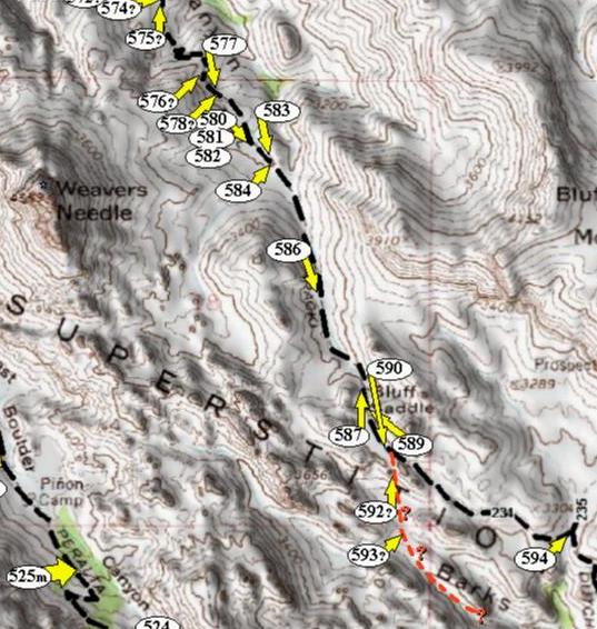
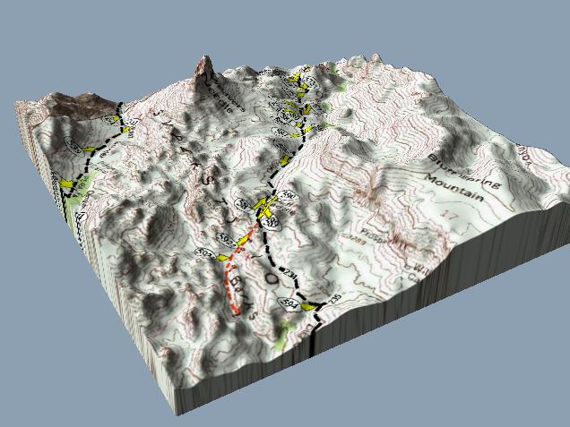
We ended up having to backtrack to the point of the trail shown in photo 592 without knowing for sure that that was even where we got off the trail. Once we were back up there, it quickly became apparent that Eric had been right to question me back at photo 592.